
Day 1 - Toronto to Chesterton IN
Day 2 - Chesterton IN to Rochester MN
Day 3 - Rochester MN to Lincoln NB
Day 4 - Lincoln NB to Denver CO
Weekly recap with more photos
Day 5 - Denver CO to Rapid City SD
The Curtis Hotel Denver CO funky themed floors
Day 6 - Rapid City SD Mount Rushmore City of Presidents
Day 7 - Rapid City SD to Billings MT Crazy Horse and Little Big Horn
Day 8 - Billings MT to Driggs ID
Day 9 - Jackson Hole WY and Grand Teton NP
The Curtis Hotel Denver CO funky themed floors
Day 6 - Rapid City SD Mount Rushmore City of Presidents
Day 7 - Rapid City SD to Billings MT Crazy Horse and Little Big Horn
Day 8 - Billings MT to Driggs ID
Day 9 - Jackson Hole WY and Grand Teton NP
September 14
We headed out at 7AM for the drive to Yellowstone. It was a cool start at 10 C. and still dark.
We cross into Wyoming. The drive was almost exactly two hours.


Idaho to Wyoming to Montana
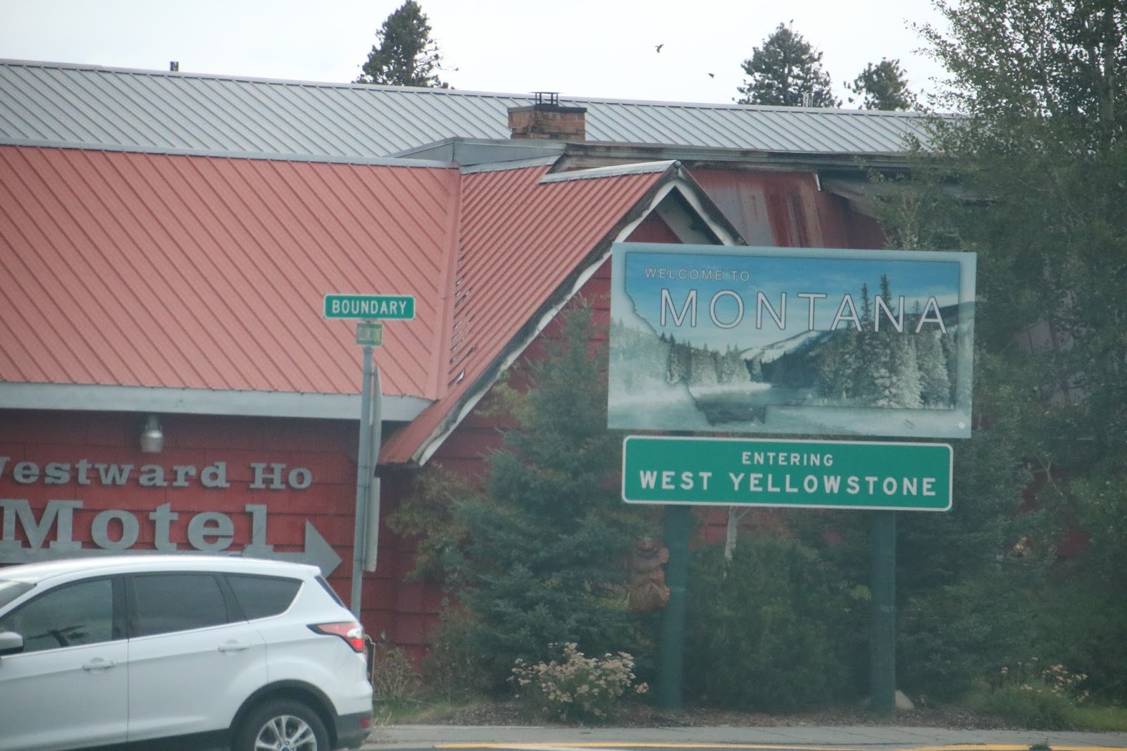
We're entering the park at the west entrance. We had paid $50 entrance fee yesterday at Grand Teton NP which is for seven days and includes Yellowstone.

Just in case we don't see any live animals like yesterday! In the town of Yellowstone.


Into the park.


1937 WHITE MODEL 706 YELLOWSTONE PARK BUS


Seriously!

What's a rut, you ask or did I make a typo?
Many couples experience a period in their relationships where the romance department falls by the wayside. It's commonly known as a rut. However, for bison, the term rut refers to the exact opposite.
It wasn't covered with bison, but enough for us!

Can you feel our excitment? Bison!


Ojo Caliente—Spanish for “hot eye”—that discharges hot water into the Firehole River.

Much of Yellowstone sits inside an ancient volcanic caldera (the exploded crater of a volcano). The last major caldera forming eruption occurred 600,000 years ago.


John is asking why are we stopped? I point out this guy who then ambled across the road.


It's steamy everywhere you look.


It is not warm and starting to rain. We have the bright idea to stop at the Old Faithful Inn, get a latte and wait for Old Faithful. There are viewing benches but I had read you got a great view from the inn itself.
Well, no to the coffee, there is one little stand with a line up and nothing interesting to drink. The cafeteria doesn't open until 11:30 talk about wasting a money making opportunity.
We did get window seats at the last window on the left.


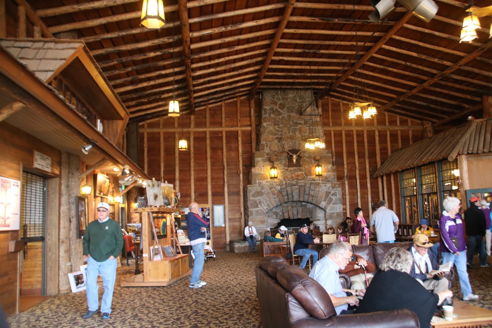
The crowd is gathering in the rain, we are cozy inside.

We were told 60-90 minutes give or take 10 minutes. So scheduled for 11:40 we went at 11:30!


We scampred out to escape the crowd.
The Hwy 191/89/287 route through Yellowstone National Park crosses the Continental Divide three times. The center crossing is an elevation of 8391 feet, about 14 road miles SE of Old Faithful and about 1 mile west of Little Thumb Creek.
We've crossed the Continental Divide several times in New Mexico and in Mazatlan Mexico.

Our lunch spot.

We're heading to West Thumb.

Spotting lots more bison.


Mud Volcano Area, also known for Black Dragon's Caldron, Sour Lake, Mud Caldron, Dragon's Mouth Spring, and Sulfur Caldron, is very acidic. Iron sulfide is responsible for the dark-gray, blacker brown-colored water, while hydrogen sulfide produces the "rotten egg" smell common to the Mud Volcano area.


Union Falls


Yellowstone's first superintendents struggled with poaching, vandalism, squatting and other problems. In 1886, the U.S Army soldiers marched into Mammoth Hot Springs at the request of the Secretary of the Interior and took charge of Yellowstone. Soldiers oversaw Fort Yellowstone's construction—sturdy red-roofed buildings still in use today as the Albright Visitor Center, offices, and employee housing.

Yellowstone’s main post office was one of 1,007 post offices constructed from 1935 to 1938 “with a view to relieving countrywide unemployment.” Using standardized plans developed from guidelines provided by the Treasury Department, these post offices were built in sizes and styles that reflect transitions in architectural design and the context of the communities in which the offices were located. The Yellowstone Post Office is a concrete building with a hipped roof in the French Renaissance Moderne style, compatible with the Art Moderne style ornament on the nearby Mammoth Hot Springs Hotel, which was partially rebuilt in 1936. The post office lobby has walls of travertine from a quarry outside the park’s north entrance.

Our lunch spot.

We're heading to West Thumb.

Spotting lots more bison.


Mud Volcano Area, also known for Black Dragon's Caldron, Sour Lake, Mud Caldron, Dragon's Mouth Spring, and Sulfur Caldron, is very acidic. Iron sulfide is responsible for the dark-gray, blacker brown-colored water, while hydrogen sulfide produces the "rotten egg" smell common to the Mud Volcano area.


Union Falls


Yellowstone's first superintendents struggled with poaching, vandalism, squatting and other problems. In 1886, the U.S Army soldiers marched into Mammoth Hot Springs at the request of the Secretary of the Interior and took charge of Yellowstone. Soldiers oversaw Fort Yellowstone's construction—sturdy red-roofed buildings still in use today as the Albright Visitor Center, offices, and employee housing.


Wo, John, stop! There's an elk!!!


There is a sign posted that the road from Norris to Mammoth is closed. We plan on taking the road from Mammoth to the West entrance. We get down the road and it is closed. This adds an hour to our trip plus we got behind a tourist who couldn't read the "slower traffic use the pullouts", delaying us further and it starts raining hard.


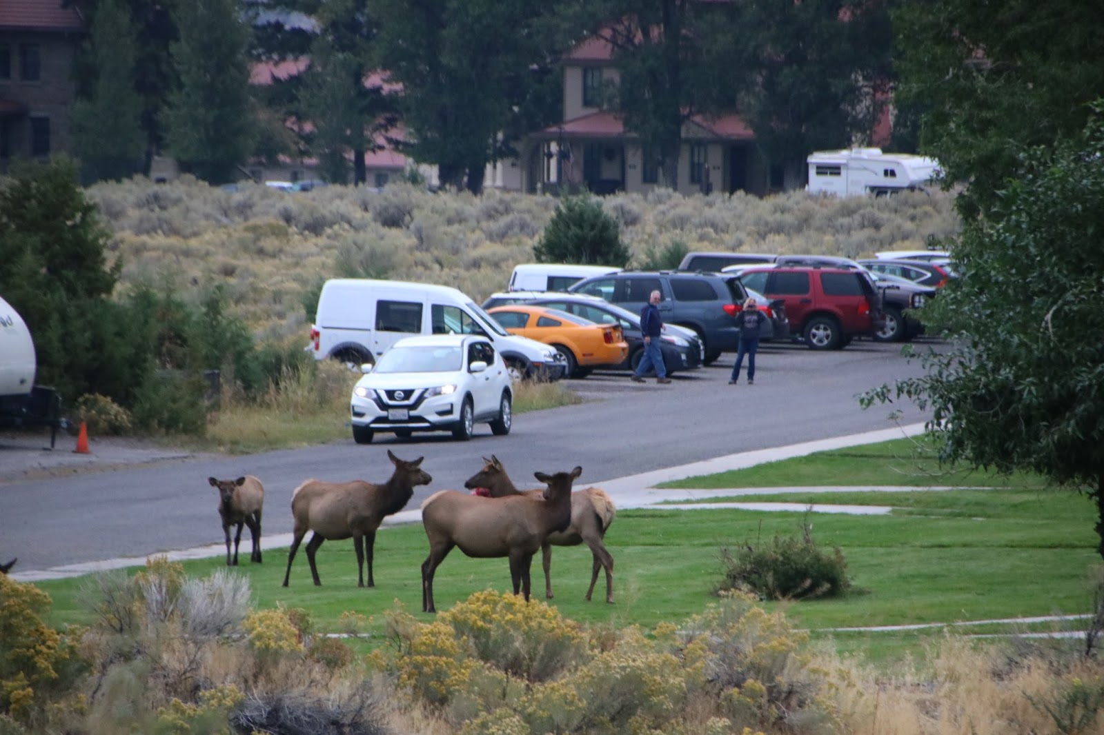


And we were treated to this! Elk.


13 hours on the road, 311 km in the park. definitely time to settle in.


That was a very big day. Don't you have elk at home? Like in Canada? I thought we saw some.
ReplyDeleteAn utterly magnificent landscape! You were spoiled for wildlife!
ReplyDelete